
The short version
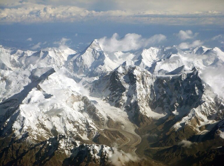
Everest Base Camp on the Tibet side is the end of a long drive south from Lhasa, a stark plateau settlement at about 5,200 meters where the road stops and the north face of Everest fills the view. It is not the climbers’ camp you see in expedition films; that is higher and closed to visitors. What you get is the closest the road brings you to the mountain, with the prayer-flag-framed outlook and the cold thin air that makes every step an effort. I did the drive in early October and the mountain was clear at dawn, which is the only time it shows; by midday the cloud usually socks it in. The trip is less about a place and more about the road: two days each way through passes above 5,000 meters, with the Potala Palace and the Namtso as the warm-up acts.
This guide covers the drive, the altitude, the permits, what to expect at the camp, and how the base camp fits a Tibet trip. For the plateau table, the Tibetan food guide covers what you will eat on the way.
What Everest Base Camp Tibet is
The Tibet-side base camp, called EBC in the permits and Basong in the paperwork, is a tourist enclosure below the mountain, reached by the road that runs from Lhasa through Gyantse, Shigatse, and Tingri. The old tented camp at the foot of the face was moved back a few kilometers for environmental reasons, and visitors now stay at the Rongphu area or the designated tourist base, from where a shuttle runs the last stretch to the viewing point. The north face of Everest from here is the classic postcard, and on a clear morning it is the reason people endure the drive. The mountain is the draw; the camp itself is a cold, basic, wind-scoured stop with a fence of prayer flags and the Rongphu Monastery, the highest in the world, a short walk above it.
The drive from Lhasa
This is the hardest part of the trip and the part to plan around. The standard route:
- Day 1, Lhasa to Shigatse (about 250 km): over the Gampala pass and past Yamdrok Lake, a turquoise wound in the hills. A long but scenic day.
- Day 2, Shigatse to Tingri to EBC (about 350 km): over the Gyatso La pass at 5,200 m, then down to the base camp road. Arrive late, sleep cold.
- Day 3, dawn at the view, drive back: the mountain shows at first light; by afternoon you are on the road north.
Most people do it as a four-day loop with a night in Shigatse and the return via a different pass. A private car with a driver is the norm, because the permit and the checkpoints make independent travel impractical for foreign visitors.
| Leg | Est. time | High point |
|---|---|---|
| Lhasa to Shigatse | 5-6 hours | Gampala pass, ~4,900 m |
| Shigatse to EBC | 6-8 hours | Gyatso La, ~5,200 m |
| EBC view to Lhasa | 2 days return | Multiple passes over 5,000 m |
The road towns
Gyantse has the Kumbum, the tiered stupa that is the best stop between Lhasa and Shigatse, and the old dzong ruin above the town. Shigatse is the second city of Tibet, with the Tashilhunpo Monastery, the seat of the Panchen Lama, worth a half day even if you are rushing for the mountain. Tingri is the last real town before the camp, a few guesthouses and the last hot meal before the high plain; the town exists because of the road, and the guesthouses are basic but warm. None of these are the destination, but each one breaks the drive into days you can survive, and each gives the acclimatization a chance to work before the camp night.
Altitude and the permits
The camp sits at 5,200 meters, higher than Namtso and high enough that most visitors feel it hard even after Lhasa. The altitude sickness guide is required reading: acclimatize in Lhasa for several nights, hydrate, move slowly, and watch for warning signs. The sleep at the camp is the worst night of the trip for most, cold and breathless, and a portable oxygen canister is common but not a substitute for acclimatization.
You need the Tibet Travel Permit on top of your China visa, arranged through a registered agency, plus the frontier pass for the EBC area. The Tibet permits note covers the current paperwork; it changes, so confirm with the agency before you book, and carry your passport and permits at every checkpoint. The road has several, and they are not advisory.
What to expect at the camp
The viewing point is a flat stretch with a fence of prayer flags and the north face beyond. The shuttle from the tourist base runs early; the dawn light on the summit is the shot, and the wind is constant. There is a monument, a few stalls selling badges and instant noodles, and the monastery above. The cold is the constant: even in October the night drops well below freezing, and the wind cuts. Dress for a polar morning and you will be comfortable; dress for autumn and you will regret it. Drones are out of the question this close to the frontier, and the photography stops at the viewpoint; the border zone rules are strict and the guards enforce them.
Food on the road
The plateau diet carries you: tsampa, yak meat, butter tea, and the noodle soups that warm you at altitude, with the better versions in the Tibetan food guide. On the road the towns serve basic hot meals; the camp has the stall food and little else. Eat a warm lunch before the final climb and carry water and snacks, because the high passes have nothing. In Shigatse and Gyantse you can find a decent Tibetan or Sichuan restaurant; in Tingri the guesthouse kitchen is the whole menu. Budget for simple food and carry the calories you need for the altitude.
What it costs
In 2025 the going rate for the four-day loop was roughly 700 to 1,200 RMB per person in a shared van with a driver and permits included, and a private car for two ran considerably higher. The price is almost all car and permit; the hotels are cheap. Book through a Lhasa agency, confirm what is included, and remember the permit paperwork needs your visa and passport copies in advance. Prices and rules change; confirm with the agency when you book.
When to go
April to May and September to October are the stable windows; the mountain is most likely to show in the clear autumn air. Winter closes the road under snow and is brutally cold; the summer monsoon brings cloud that hides the peak most afternoons. The best time to visit China is a poor proxy here, because Tibet runs on altitude and weather you cannot plan around; aim for early autumn and build buffer days in case the passes close.
Quick facts
- The Tibet-side base camp sits at about 5,200 meters, the road’s end below the north face.
- The drive from Lhasa is two long days each way over passes above 5,000 m.
- You need a Tibet Travel Permit plus the frontier pass, through a registered agency.
- The mountain shows most often at dawn; afternoon cloud usually hides it.
- The old tented camp was moved back; a shuttle runs the last stretch to the view.
- Acclimatize in Lhasa first; the altitude is the real risk, not the distance.
Frequently asked questions
How many days does it take?
Four days is the standard loop from Lhasa, with a night in Shigatse and the dawn at the camp. Shorter is possible but rushes the passes and the acclimatization, which is unwise at this height.
Is the altitude dangerous?
It can be. Sleep at 5,200 m is hard on most people. Acclimatize in Lhasa, read the altitude sickness guide, and descend if symptoms worsen. Oxygen helps but is not a cure.
Can I go independently?
No, not as a foreign visitor. The permit and the checkpoints require an agency and a driver. The Tibet permits note explains the current rules; confirm them before you book.
Will I see the mountain?
If you go at dawn in the clear season, often yes; in the afternoon or the monsoon, often no. Build a buffer day and do not plan the whole trip around one view.
What should I pack?
Down jacket, wind shell, gloves, hat, sunglasses for the glare, and water. The camp is colder than Lhasa by a long way; dress for a polar morning.
How much does it cost?
In 2025 the shared-van four-day loop ran about 700 to 1,200 RMB per person with permits and driver; a private car cost more. The car and the permits are the whole price, so compare what the agency includes.
How does it compare to Namtso?
Namtso is a lower, calmer day trip; EBC is higher, longer, and harsher, with the mountain as the prize. Both need the same permit and acclimatization, so they pair in one Tibet run.
Is it worth the drive?
If the mountain matters to you, yes; the dawn north face is a singular view. If you dislike long cold drives at altitude, the Potala Palace and Namtso give you Tibet with less road.
Planning a Tibet roof-of-the-world route
Everest Base Camp is the far end of a Tibet trip that should start with the Potala Palace and the Jokhang Temple in Lhasa, add Namtso for altitude practice, then drive south over the passes. It needs the permit, the acclimatization, and a driver, so it is the most planned stop in the country. Tell us your Lhasa nights, your altitude comfort, and your dawn-or-bust stance on the mountain, and we can set the buffer days so a closed pass does not sink the view. The camp is fixed; the road to it is what we shape.
Written by the ChinaTravelFood editorial team.